The Divide: A Historical Overview of a Rural Community in Kerr County
Published: September 13, 2007
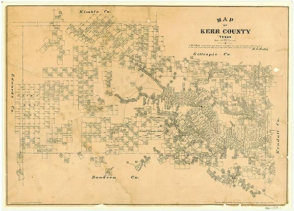
The Divide is a dispersed rural community located along several miles of State Highway 41 about thirty miles west-northwest of Kerrville in western Kerr County. In the early 1880s settlers homesteaded along this strip of Edwards Plateau that functioned as a natural dividing line for rainfall run-off. This strip of land, five to fifteen miles wide, that ran east-west became known as "The Divide." With the use of the windmill to pump water and the advent of barbed wire, the area became a preferred region for ranching cattle, sheep, and Angora goats. The Hughes, Dietert, Klein, and Y-O ranches were located in the area. The first school was held in 1882. In 1893 a one-room school was constructed on the Wharton Ranch and later moved to the Leinweber Ranch in 1905. Within a few years a new wooden structure was built on the Dee Hughes Ranch, and the Divide Common School District was formed. With the construction of State Highway 41 in the 1930s the school was moved to land donated by the F. B. Klein family, and a stone building was erected. In the 1940s the Divide Presbyterian Chapel served area families. Residents constructed a community building in 1949, the same year western Kerr County received electric service. Two rooms were added on to the school in 1960, with the enrollment of forty-five students. Throughout the latter decades of the twentieth century, The Divide maintained the church, school, a volunteer fire department, and a business—Garven's Store. Subdivisions within the Y-O Ranch provided rural Hill Country living for retirees that moved into the area. In 2000 The Divide had a population of 250. The Divide School, one of the few "one-room" schools still operating in the United States, served pre-kindergarten through sixth-grade schoolchildren. Ranching and hunting, including exotic game hunting, were major economic activities in The Divide.
Bibliography:
Places:
The following, adapted from the Chicago Manual of Style, 15th edition, is the preferred citation for this entry.
Laurie E. Jasinski, “The Divide, TX,” Handbook of Texas Online, accessed March 09, 2026, https://www.tshaonline.org/handbook/entries/divide-tx.
Published by the Texas State Historical Association.
TID:
HLT44
- September 13, 2007